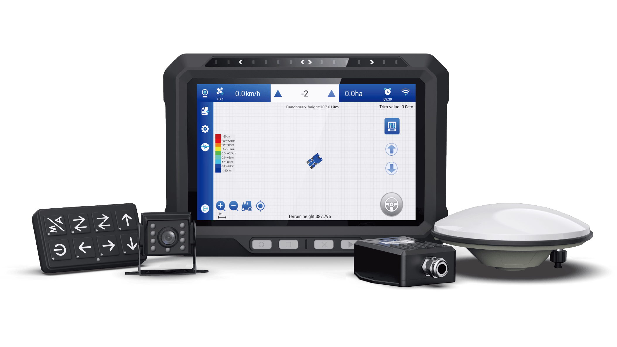
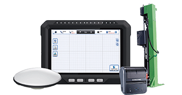
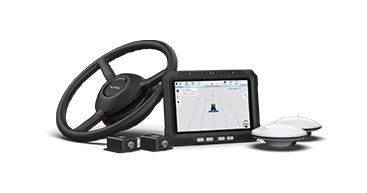
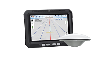
W20 Land Leveling System

The W20 Precision Land Leveling System integrates high-precision satellite technology with advanced automation to deliver exceptional land leveling for large-scale agricultural fields. Designed for efficiency and accuracy, it transforms traditional land leveling processes, ensuring optimal preparation for planting.

官网视频展示区域替代

Leveling Accuracy ≤2.5cm

Network RTK Technology

ISOBUS Compatibility

Correction Services

Terrain Compensation

IP67

Product Features

High Precision to Increase Efficiency

The system is compatible with both horizontal and slope modes which achieves a leveling accuracy of ≤2.5cm (1 inch). Operating with highly precision in land leveling reduces the impact of drought and flooding, optimizes soil moisture levels, and ensures uniform irrigation. It also conserves water and fertilizer resources, retains soil nutrients, and ultimately increases agricultural productivity.

Versatile and Adaptable

Compatible with Allynav's Auto-steering products and various leveling machinery including standard graders, dozers, and leveling machines. The system can be adjusted to suit different work scenarios, making it adaptable to various terrain and soil conditions.

ISOBUS Compatibility

Supports ISOBUS and multiple interfaces, enabling easy expansion of functionalities. With additional hardware modules, it can cover the entire agricultural process from plowing to harvesting, all with a single machine.

Stable and Reliable Performance

The system is unaffected by adverse weather conditions such as strong winds, fog, or dust storms, ensuring continuous and stable operation. It can operate in areas without network coverage by connecting to fixed or mobile base stations.Within the easy installation and removal features it ensures continuous, deviation-free operation under various conditions.

Remote and efficient control

The system supports Can layout controlloer, button, and touchscreen controls, offering a user-friendly operation experience. With intuitive elevation display, smart algorithms, and dynamic compensation technology, it ensures efficient land leveling, unaffected by terrain variations.

Core applications

Versatile Field Adaptability

Versatile Field Adaptability

Multi-Implement Efficiency

Multi-Implement Efficiency

Product Parameters

Tablet Display

CPU Model: i300PA, MT8768CA,IMG GE8320 650MHz

CPU Specification:4*A53@ 2.0GHz+4*[email protected]

Operating System: Android 10, 64Bit

RF Specifications:

Mode:LTE/UMTS/GSM/EDGE

Europe & Asia & Africa: LTE Band 4G
B1/3/5/19/26/7/8/20/34/38/39/40/41
UMTS B1/2/5/8 GSM B2/B3/B5/B8

UMTS Bands

GSM Bands

Storage:ROM + RAM, Memory Type  2GB+32GB LPDDR3x

RTK Positioning Accuracy (RMS):

Horizontal: 8 mm + 1 ppm

Vertical: 15 mm + 1 ppm

Initialization Time: <5 S (typical)

Initialization Reliability: >99.9%

First Fix Time: <30

Display Specifications: Resolution  800 * 1280 p

GNSS Antenna

Frequency :

GPS L1/L2/L5

BDS B1/B2/B3

GLONASS L1/L2/L3

GALILEO E1/E5a/E5b/E6

QZSS L1/L2/L5/L6

IRNSS L5

L-Band

Operating Temperature:-20℃~+70℃

Storage Temperature:-40℃~+85℃

Humidity:95% non-condensing

Controller

Communication Interface: CAN

Input Control: 2 analog inputs (voltage)

Output Control: 2 outputs (12V switching signal/PWM)

Operating Voltage: DC 9-36V (with power protection)

Output Power: ≥60W

Protection Level: IP67

Operating Temperature: -35 to +65℃

Storage Temperature: -40 to +70℃

Shopping Basket