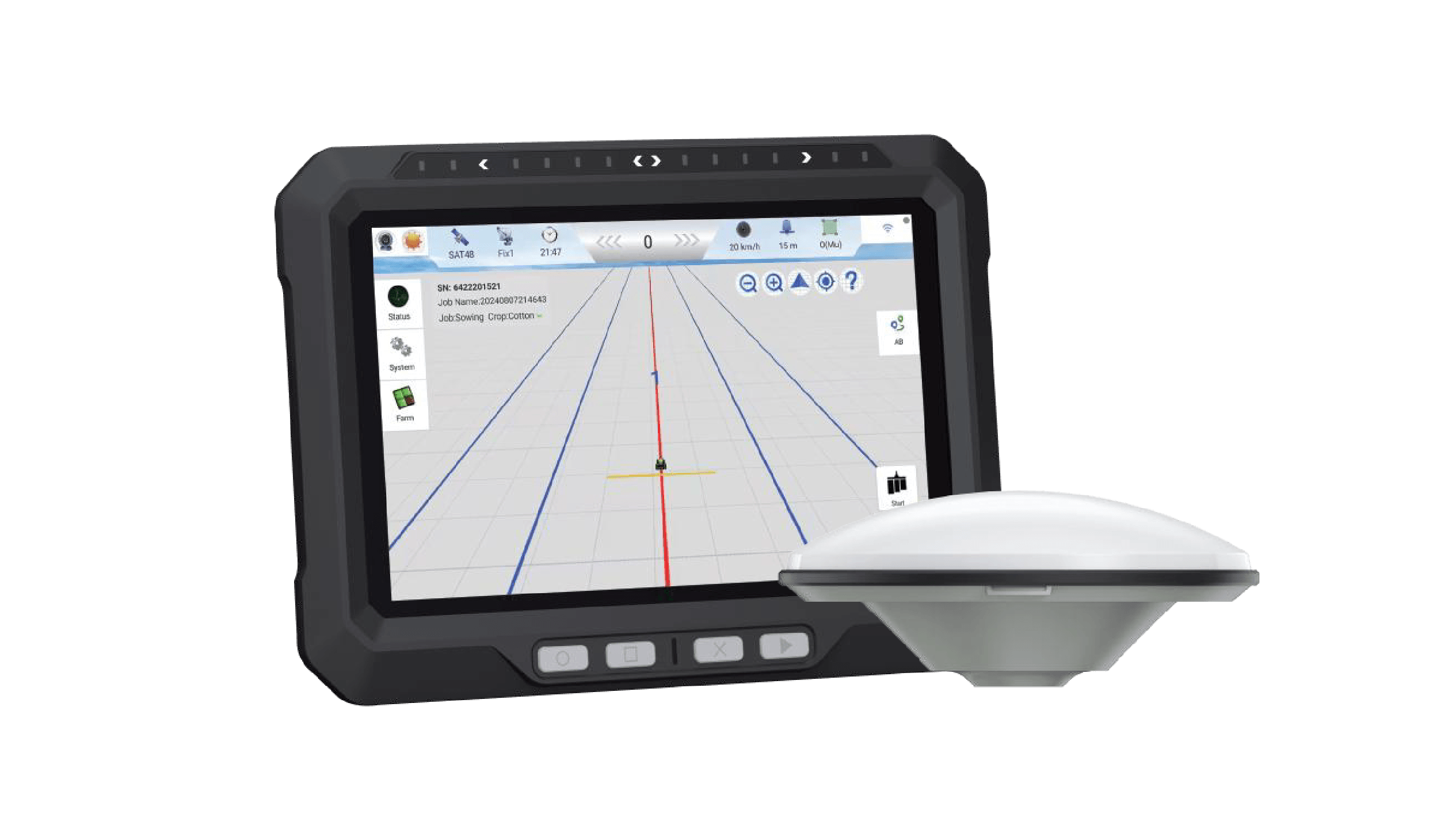
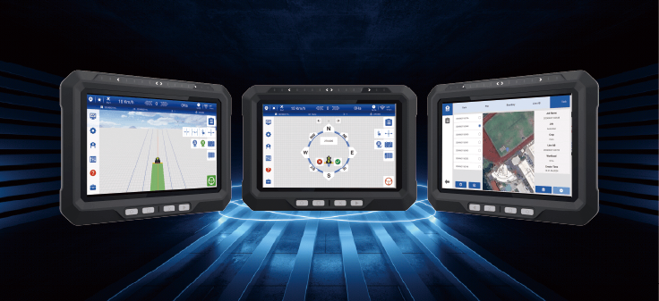
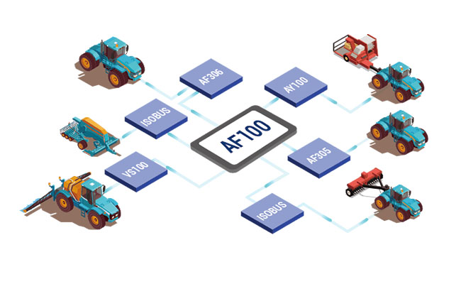
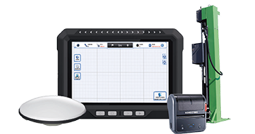
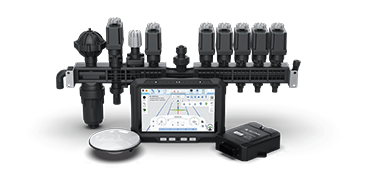
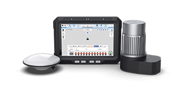
AF100 Assisted
Steering System

The AF100 assisted steering system is an agricultural machinery operator assistance system developed by AllyNav based on the GNSS satellite navigation system and high-precision positioning tablet. The system uses GNSS satellite positioning to determine the vehicle’s location, calculates suitable path plans through algorithms, and displays deviations accurately for operators to make adjustments swiftly, ensuring precise agricultural operations. It addresses issues such as poor precision in manual operation modes and operational limitations.
AF100shipintidai
Play Video

USER-FRIENDLY INTERFACE

EXTENSIVE EXPANDABILITY

ISOBUS COMPATIBILITY

PRECISION ACCURACY OF ±2.5CM

ALLYNAV MULTI-PLATFORM INTEROPERABILITY

ADVANCED CORRECTION SERVICES

Product Features

Extensive Expandability

Seamless integration with ISOBUS and multiple interfaces allow for easy expansion to cover all farming operations, from tilling to harvesting, with just one machine. The system's design upgrades automated driving while reducing costs and complexity through high integration and fewer components.

User-Friendly Interface

User-Friendly Interface

Advanced Correction Services supports high accuracy positioning

This system uses advanced Network RTK technology that includes breakpoint continuation, allowing it to function normally for up to 10 minutes even if differential data is temporarily unavailable. It achieves straight-line accuracy of ±2.5cm and curve accuracy of ±5cm, ensuring continuous, precise operation without deviation. This technology provides reliable performance, giving users peace of mind in their tasks.

Allynav Multi-Platform Interoperability

Work data is stored securely in the cloud, allowing easy sharing across multiple vehicles. The system supports remote adjustments, troubleshooting, and remote software upgrades. If the power is off, it can resume operations using stored data; there is no need to restart the task from the beginning.

Core applications

PRECISION PLANTING

EFFICIENT SPRAYING

Harvesting

Tillage and Soil Preparation

Product Parameters

GNSS Antenna

Antenna size: Φ152 × 62.2mm

Frequency:

GPS: L1/L2/L5

BDS: B1/B2/B3

GLONASS:L1/L2/L3

GALILEO:E1/E5a/E5b/E6

QZSS: L1/L2/L5/L6

IRNSS: L5

L-Band

Tablet display

SYSTEM:

8-core, 2GHz

2G RAM

32 GB ROM,

supports TF card (expandable up to 256 GB)

Android 12.0

DISPLAY:

Size: 10.1-inch

Resolution: 1280 × 800p

Brightness: 750 nits

Haptic touch: supports 10-point touch

Power supply: 9 to 36 V DC

RTK Positioning Accuracy (RMS):

Horizontal: 8mm + 1ppm

Vertical: 15mm + 1ppm

Initialization Time: <5S (typical)

Initialization Reliability: >99.9%

First Fix Time: <30S

Pass to pass accuracy: ≤±2.5cm (RTK)

Dimensions: 284.7 × 204 × 49.5 mm

Weight: 1.7 kg

Ingress protection rating: IP67

COMMUNICATIONS:

2.4GHz WiFi, IEEE802.11a/b/g/n/ac

Supports Wi-Fi hotspot sharing

4.2BLE

4G/LTE

Built-in microphone (optional)

Built-in speaker

CAN × 2

RS-232 × 2

RS-485 × 1

DI × 2 ,DO × 2

USB 2.0 × 1

12 V DC OUT × 1

Display

LCD: 8″ HD

Brightness: 400Nits, sunlight readable

Resolution: 1280*800 pixels

Touch Panel: Capacitive screen, support glove’wet hand

Shopping Basket