 Skip to content

Grade Control System for Excavators and Earthmoving Precision
Real-time grade guidance to improve excavation accuracy, reduce rework, and boost construction efficiency across complex terrains.
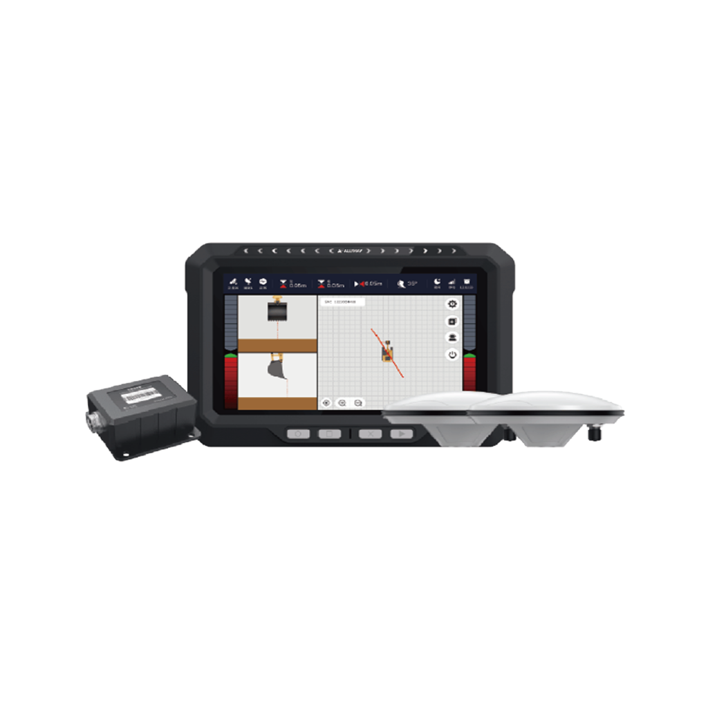
EGS101 Intelligent Grade Control System

Why Choose AllyNav for Precision Grade Control
AllyNav’s intelligent grade control system is designed to enhance accuracy, reduce operator workload, and increase productivity across trenching, land leveling, slope grading, and embankment construction.
Consistent Accuracy: By integrating high-performance GNSS antennas and IMU sensors, the system ensures ±3 cm precision—even under complex tilt and slope conditions. The real-time elevation tracking allows operators to maintain consistent results without repeated manual checks or rework.
Operator-Friendly Design: The Android-powered 10.1-inch tablet offers a clean, intuitive interface with one-click height calibration and real-time excavation visuals. Even inexperienced users can achieve expert-level output, reducing training costs and downtime.
Seamless Excavator Compatibility: Designed for a wide range of excavator models, the system supports multi-type configurations with automatic bucket angle compensation, ensuring full functionality across different equipment profiles.
Durable Industrial Build: All hardware components—from the sensors to the tablet—are IP67-rated and shock-resistant, ensuring reliable operation in dusty, wet, and high-vibration job sites. Free lifetime software upgrades ensure your system stays future-proof.
Versatile Applications: Ideal for use as a grade control system for excavators, it also serves high-standard needs in land leveling, canal grading, and slope shaping. Whether you’re in precision construction or working on rugged terrain, the system delivers repeatable, measurable results.
Discover More Precision Applications
Frequently Asked Questions
What is the difference between 2D and 3D grade control systems?
A 2D grade control system uses lasers or physical benchmarks to maintain elevation and slope on a single plane—ideal for simple tasks like flat grading. In contrast, a 3D system uses GNSS and sensors to model the entire terrain in real time, providing dynamic height, slope, and position data for complex projects.
How accurate is a typical excavator grade control system?
Accuracy varies by system type and technology. GNSS-based 3D systems, such as those used in high-standard grading, can achieve up to ±3 cm precision in real-time. This is crucial for applications like trenching, slope control, and fine grading where manual methods fall short.
What are the main components of a grade control system?
A complete system usually includes a GNSS antenna for positioning, an IMU sensor for orientation, and a display tablet for visualization and control. Some systems also integrate CAN bus communication, wireless connectivity, and real-time feedback to improve workflow efficiency.
What types of excavator models are compatible with AllyNav's EGS101 system?
The EGS101 is designed for wide compatibility. It supports various excavator models used in land leveling, trenching, embankment shaping, and slope grading, with fast setup and intuitive controls to simplify integration across multiple construction sites.


")


