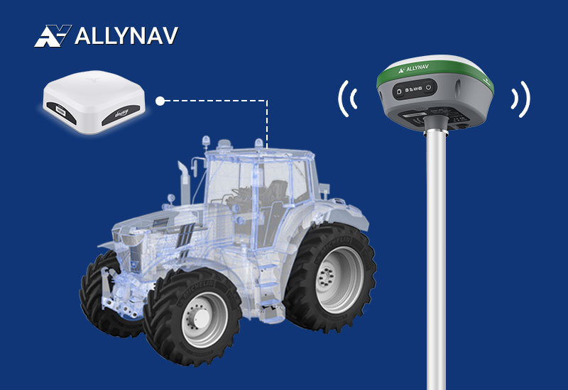
In the evolving landscape of agriculture, precision farming has emerged as a pivotal approach to enhance productivity and sustainability. Central to this advancement are Global Navigation Satellite Systems (GNSS) and Real-Time Kinematic (RTK) positioning, which provide the accuracy necessary for modern agricultural practices.
Understanding GNSS and RTK in Agriculture
GNSS encompasses satellite systems like GPS, GLONASS, Galileo, and BeiDou, offering global positioning data. RTK is a technique that refines GNSS data to achieve centimeter-level accuracy by correcting signal errors in real-time. This precision is crucial for applications such as automated machinery guidance, variable rate application of inputs, and field mapping.
What is GNSS?
GNSS (Global Navigation Satellite System) is a space-based technology that delivers Positioning, Navigation, and Timing (PNT) information by broadcasting signals from satellites to receivers on Earth. GNSS encompasses all satellite navigation systems, including global systems like GPS (United States), GLONASS (Russia), Galileo (European Union), and BeiDou (China), as well as regional systems like NavIC (India) and QZSS (Japan).
The key functionality of GNSS lies in its ability to calculate precise positioning by measuring the time it takes for signals to travel from satellites to Earth-based receivers. These receivers decode the signals into usable data, such as latitude, longitude, and altitude. The applications of GNSS extend from personal navigation systems to high-precision operations in industrial sectors.
Differences Between GNSS and GPS
While GPS is often used interchangeably with GNSS, it is only one type of GNSS. Each GNSS system varies in ownership, signal structure, and precision.
By integrating signals from multiple GNSS constellations, users can achieve higher accuracy and resilience to signal disruptions.
How GNSS Works?
Global Navigation Satellite Systems (GNSS) are integral to modern navigation, enabling precise positioning and timing across various applications. Understanding their operation is essential for leveraging their capabilities effectively.
Satellite Constellation
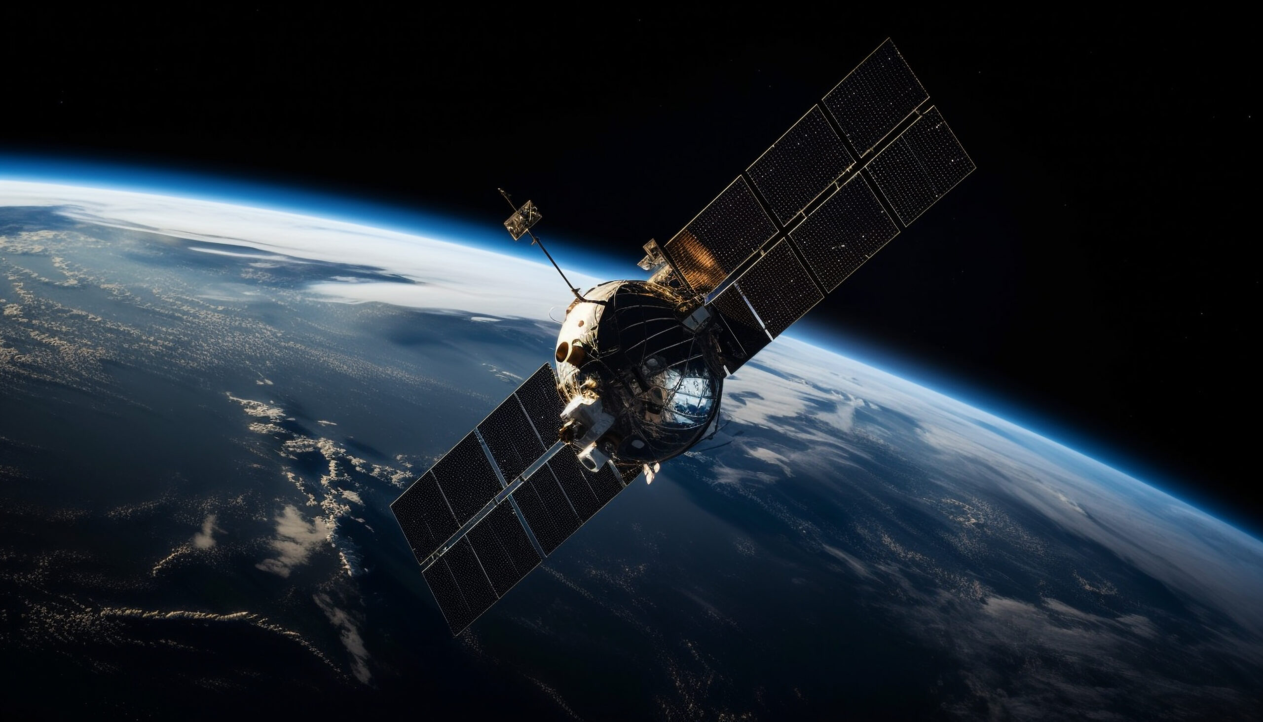
GNSS comprises multiple satellites orbiting Earth in specific trajectories, ensuring global coverage. Typically, a constellation requires 18 to 30 satellites to provide continuous signals to receivers worldwide.
Signal Transmission
Each satellite transmits signals containing two critical pieces of information:
- Time Stamp: The exact time the signal is sent, based on the satellite’s onboard atomic clock.
- Orbital Data: The satellite’s precise position in space at the time of transmission.
These signals are broadcast on specific frequencies, such as the L1 and L2 bands, facilitating communication with GNSS receivers.
Signal Reception
GNSS receivers, equipped with antennas and processing units, capture signals from multiple satellites. By noting the time delay between signal transmission and reception, the receiver calculates the distance to each satellite.
Trilateration
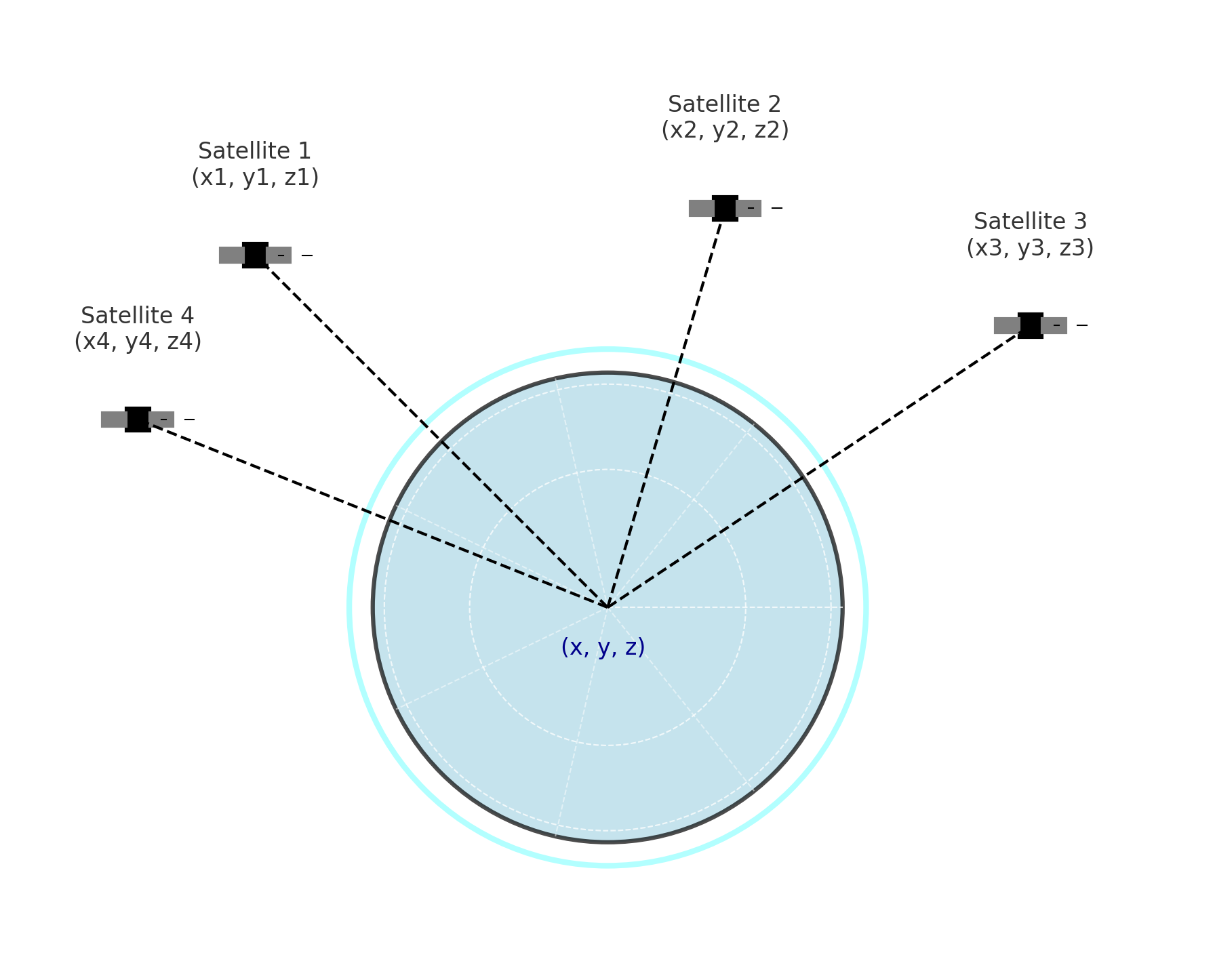
To determine its exact position, a GNSS receiver employs trilateration:
- Distance Measurement: Calculates the distance to at least four satellites.
- Position Calculation: Uses the known positions of these satellites to compute its own location in three-dimensional space (latitude, longitude, and altitude).
This process accounts for any discrepancies in the receiver’s internal clock, ensuring accurate positioning.
Data Processing
The receiver processes the collected data to provide precise positional information and accurate time, which are crucial for various applications, including navigation, mapping, and timing services.
Understanding these components and their interactions is vital for effectively utilizing GNSS technology across diverse fields.
What is RTK?
Real-Time Kinematic (RTK) positioning enhances Global Navigation Satellite System (GNSS) accuracy by correcting errors from atmospheric delays and satellite clock inaccuracies. While standard GNSS provides positional accuracy within 2–4 meters, RTK achieves centimeter-level precision by processing correction data from a fixed base station or network.
How RTK Works?
RTK operates through the following process:
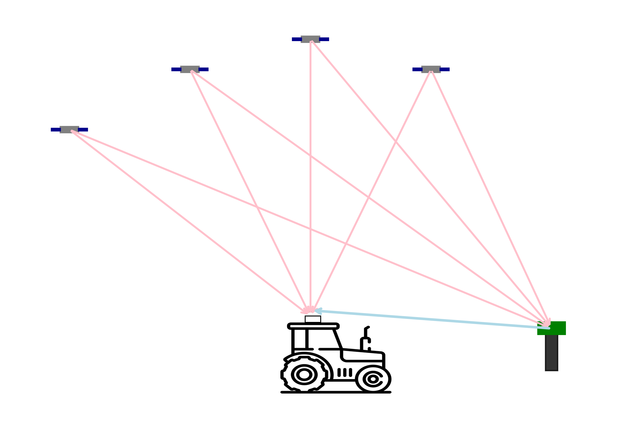
- Base Station Transmission: A stationary base station with known coordinates continuously monitors GNSS signals and calculates correction data. This data accounts for errors such as atmospheric disturbances and satellite clock biases.
- Correction Signal Delivery: The base station transmits these corrections to the rover (mobile GNSS receiver) via radio signals or internet-based services like NTRIP (Networked Transport of RTCM via Internet Protocol).
- Rover Adjustment: The rover receives the correction data and applies it to its own GNSS measurements, refining its positional accuracy to the centimeter level.
RTK Correction Methods
RTK corrections can be delivered through various methods:
- Radio RTK (Fixed Base Stations): These are local stations set up at known locations that broadcast correction data over radio frequencies. They are highly effective within a limited range, typically up to 10–15 kilometers, making them suitable for localized applications.
- Network RTK (NTRIP Services): NTRIP utilizes a network of base stations to provide correction data over the internet. This method eliminates the range limitations of single base stations and is ideal for broader coverage areas. However, it requires a stable internet connection to function effectively.
By implementing RTK technology, industries such as precision agriculture, surveying, and autonomous vehicle navigation can achieve the high-level positional accuracy necessary for their operations.
What is the relationship between CORS and NTRIP?
CORS is the data source, while NTRIP is the delivery mechanism.
CORS provides the correction data that NTRIP transmits. Without a CORS network, there would be no high-precision corrections for NTRIP to distribute. Similarly, without NTRIP (or an equivalent delivery method), accessing CORS data in real-time would be more challenging.
Applications of GNSS and RTK in Precision Agriculture
- Automated Machinery Guidance: RTK-enabled GNSS systems allow tractors and harvesters to follow precise paths, reducing overlaps and missed areas during operations like planting and harvesting. This leads to efficient use of resources and time.
- Variable Rate Application: By integrating GNSS data with field variability information, farmers can apply fertilizers, pesticides, and seeds at variable rates tailored to specific field zones, optimizing input use and minimizing environmental impact.
- Field Mapping and Soil Sampling: GNSS facilitates accurate mapping of field boundaries and soil sampling locations, enabling detailed analysis of soil properties and informed decision-making for crop management.
Benefits of Implementing GNSS and RTK
- Enhanced Efficiency: Precise navigation reduces input costs and labor by minimizing overlaps and ensuring consistent field coverage.
- Environmental Sustainability: Targeted application of inputs based on accurate field data reduces chemical usage, lowering the risk of runoff and environmental contamination.
- Improved Crop Yields: Optimized planting patterns and input applications contribute to uniform crop growth and higher yields.
Conclusion
The integration of GNSS and RTK technologies in precision agriculture is transforming farming practices by enhancing accuracy, efficiency, and sustainability. As these technologies continue to evolve, they offer promising solutions to meet the growing global food demand while preserving environmental health.
References:
GPS.gov: Other Global Navigation Satellite Systems (GNSS)
- Pharmacology of the Therapeutic Approaches of Gout | IntechOpen
- GNSS – Global Navigation Satellite Systems: GPS, GLONASS, Galileo, and more | SpringerLink
- https://en.wikipedia.org/wiki/Satellite_navigation
- Global Navigation Satellite System [Explained]
- https://geospatialworld.net/blogs/how-gnss-works/?utm_source=chatgpt.com
- GNSS Meaning, Working, Applications
- Veripos Help Centre
- Renal Tumor Biopsies: A Shift towards Improving Outcomes in the Management of Small Renal Masses | IntechOpen
- RTK Corrections: What This Means & How It Works
- RTK corrections explained: from base station to NTRIP service – Emlid Blog
- Precision agriculture | NovAtel
- Precision agriculture grows with RTK – GPS World
- Precision Farming in Hilly Areas: The Use of Network RTK in GNSS Technology
- From Plowing to Planting: RTK Technology's Role in Precision Agriculture – HusFarm


